Join the movement to end censorship by Big Tech. StopBitBurning.com needs donations and support.
Geology, not climate change, likely triggered Nepal's deadly glacier collapse
By isabelle // 2026-09-03
Mastodon
 Parler
 Gab
Gab Copy
Copy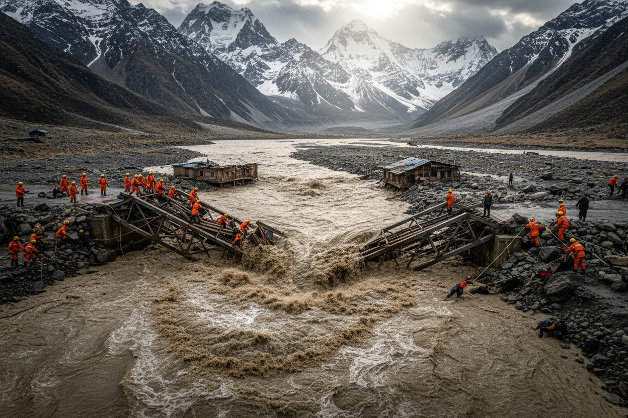
- The catastrophic glacier collapse in Nepal's Langtang valley was caused by bedrock failure, a geological process, not directly linked to climate change according to geologists.
- The disaster killed hundreds and destroyed infrastructure within minutes, with floodwaters traveling from Tibet into Nepal in just 26 minutes.
- Media outlets including The New York Times prematurely attributed the tragedy to climate change despite ongoing scientific uncertainty about the exact cause.
- Human decisions, such as constructing roads, bridges, and hydropower plants in known debris-flow pathways, significantly amplified the disaster's destruction.
- Expanding hazard mapping, monitoring networks, and building codes would save more lives than climate policy shifts in this geologically restless region.
What actually caused the deadly debris flow
According to analysis by Dr. Roger Pielke Jr., the disaster began when bedrock gave way underneath the glacier, knocking the ice above it loose and sending a massive slide of rock and ice down the mountainside. That is fundamentally a geological process rather than a climate-related one, experts say. Newcastle University geomorphologist Stuart Dunning told the Times, "I don't think we can simply say this is a result of climate change." Despite acknowledging that scientists are "still determining the exact cause" and that research could take months, the Times framed the disaster as a climate change consequence from its headline onward. The Himalayas rank among the youngest, most seismically restless mountain chains on the planet, pushed skyward by the ongoing collision between the Indian and Eurasian tectonic plates. Landslides, rock avalanches and ice failures are not unusual there. The Times' own reporting notes that similar glacier failures have struck the China-Nepal border region dozens of times since 1900 — well before modern greenhouse gas emissions rose.Human decisions amplified the disaster's destruction
Much of the devastation resulted from human choices unrelated to climate. Roads, bridges, hydropower facilities and communities had been constructed directly within known debris-flow pathways and river valleys long recognized as vulnerable to landslides and flash floods, according to experts. Building codes across the Himalayan regions of India and Nepal have done little to stop settlements and infrastructure from spreading into these unstable river corridors. One 2025 study of 257 Himalayan hydroelectric projects found that roughly two-thirds sit along potential glacial lake outburst routes, with as many as a third of them capable of facing water discharges beyond what their designs can handle. The flood destroyed or damaged multiple hydropower stations, knocking out more than 430 megawatts of power after floodwaters struck a dozen dams, according to Nepal's energy ministry. Previous disasters provide chilling previews: a 2021 rock-ice avalanche destroyed two hydropower plants in Uttarakhand, and a 2023 landslide destroyed India's second-largest dam in Sikkim, killing 55 and leaving 74 missing.Border tensions hamper early warning cooperation
The International Centre for Integrated Mountain Development reported this year that Hindu Kush Himalayan glaciers are losing ice at a faster pace than before, with the rate of loss roughly doubling since 2000 and average thinning approaching half a meter annually. The Koshi basin alone has recorded roughly two dozen glacial lake outbursts that crossed international borders, yet no system exists for real-time data sharing between India, China and Nepal. Diplomatic channels, not shared monitoring networks, remain the primary way flood warnings travel between the three countries — a gap that costs precious minutes in a region where disaster can strike in under half an hour. Experts say that far more lives would be saved by expanding hazard mapping, upgrading monitoring networks, and tightening building rules in flood-prone corridors than by any climate policy shift. The National Disaster Management Authority has called for cumulative environmental assessments of hydro projects and standard operating procedures for disaster response. But as Ruth Gamble, an environmental historian of Tibet at La Trobe University, noted: "What we are moving into is not something that we know." Nepal's tragedy is a reminder that mountains have collapsed long before anyone burned a barrel of oil, and that the money and attention poured into climate summits might be better spent on the hazard maps, monitoring stations, and building codes that could have actually saved lives this month. Sources for this article include: WattsUpWithThat.com TheFederal.com CNN.comMastodon
Parler
Gab
Copy
Tagged Under:
collapse violence disaster Fact Check Nepal depopulation truth ecology dangerous floods climate climate alarmism geology media fact watch tragedy environ real investigations overdevelopment
You Might Also Like

Russian Intelligence Service Says EU Urges Ukraine to Mobilize Women
By Garrison Vance // Share

Bessent Warns: U.S. Cannot Lose AI Race to China
By Chase Codewell // Share

Study Finds Weak EV Battery Cells Can Cut Pack Life by Nearly 23%
By Edison Reed // Share
Russian Strikes on Ukraine Border Checkpoints Disrupt Rerouted Arms Supply Lines
By Garrison Vance // Share

Iran strikes U.S. spy drone in Strait of Hormuz, escalating maritime crisis
By Willow Tohi // Share

Microplastics found in lungs linked to lung cancer, new research shows
By Willow Tohi // Share
Recent News






Popular This Week